Damergou Gr
Type Locality and Naming
Damergou (no accurate location). Joulia, 1953.
References: Furon, 1934; Joleaud et al., 1935(?); Joulia, 1953; Faure, 1966, p. 159; Fabre et al., 1983; Moody et al., 1991; Mathey et al., 1991.
Synonym: There is a possibility that the “Série crétacée de Tanout” of Joleaud et al. (1935) be equivalent to the Damergou group.
Lithology and Thickness
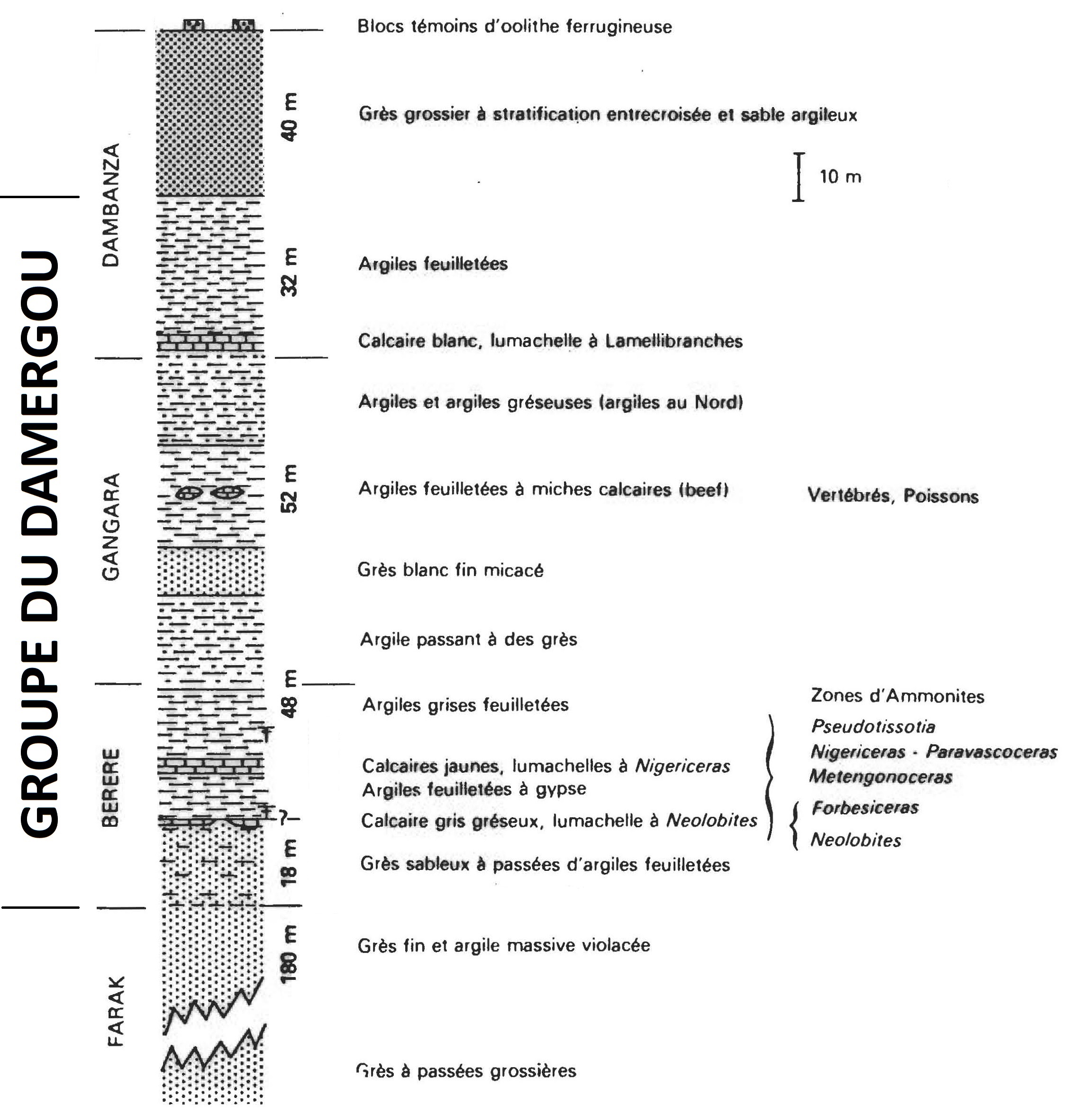
Its thickness is 179 m. Deposits including, from top to bottom (see each formation individually) (Fig. 1):
- Lower portion of the Dambanza Fm: flaky clays; at the base, a horizon of limestone with lamellibranchs;
- Gangara Fm: calcareous clays (vertebrates, fish) and fine sandstones;
- Béréré Fm:
- clays containing two calcareous ammonite levels,
- Sandstone with clay layers.
[Figure 1: Lithostratigraphy of the Damergou Gr displaying its formations (Béréré Fm to lower portion of the Dambanza Fm) (Source: Modified from Faure, 1966, p. 158)]
Relationships and Distribution
Lower contact
Underlying unit is the Farak Fm
Upper contact
Overlying unit is the Upper portion of the Dambanza Fm. (NOTE: the lower portion of Dambanza Fm is in this Damergou Gr, which is confusing!)
Regional extent
Iullemmeden Basin - Southeast Aïr & Damergou
GeoJSON
Age
Depositional setting
Marine and Continental
Additional Information
